indonesia corners

indonesia corners
Showing posts with label UNCLOS. Show all posts

Tuesday, July 19, 2016

Could Beijing Prove Their Historical Exclusive Exercise Control Over SCS?

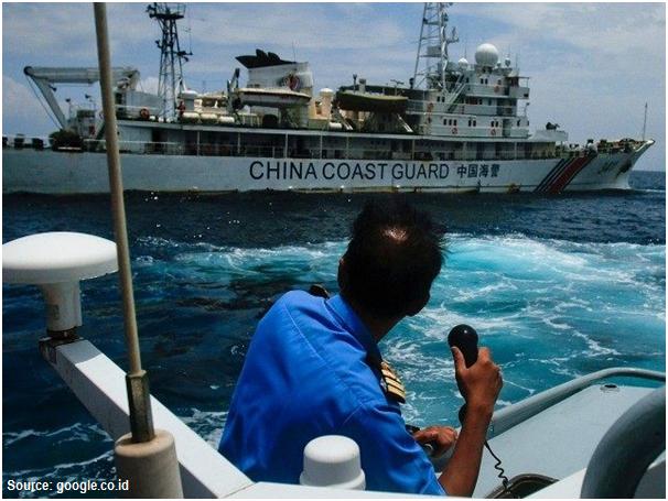
The long-awaited international tribunal verdict declaring that Chinese Nine-Dash Line had no legal basis came with no surprise. The July 12, 2016 verdict was just a simple ‘translation’ of what was written in UNCLOS 1982. What was new was its declaration on the fact that there was no evidence that China had historically exercised exclusive control over SCS

It was no surprise either that China rejected the whole verdict and declared it as null and void. They claimed that the Nine-Dash Line was nothing to do with maritime delimitation but the territorial sovereignty issue. The court has, therefore, no authority to put a hand on SCS dispute. They considered that the issue should be resolved among the conflicting nations and thus will handle it and do business as usual.


Already United States, Japan, and Australia openly demanded China to observe the Tribunal Verdict and European Union (EU) plan to do the same soon. However, no indication that ASEAN having direct interest on the SCS will follow suit, which is very gloomy, and not even a single word of sympathy uttered towards their dear college Philippine who won the case. Furiously China warned any country who criticized Chinese challenging attitude for not turning the SCS into a war arena.

Just a few days after the verdict, China announced they were planning to close off a part of the South China Sea for military exercises for a couple days. Obviously, China can do what they want to. But instead of showing forces at least China should clarify to the international community who waited for China to challenge the Tribunal Verdict that they have indeed very strong evidence on historical exercise exclusive control over SCS such as the details proves on when, where, what and which armada that had ruled the SCS waves.


The history, however, recorded only three important Chinese maritime military expeditions. The first and second expeditions were to the North towards Japan which both failed because of naval disaster as the whole armadas were wiped out by ‘kamikaze’ typhoon (1274 and 1281 AD). The third expedition was to the South purposely to invade Java in 1292 AD. The expedition was doomed to failure as the Javanese exercised their tactical trick of burning nearly the whole armadas behind the Chinese Army who had landed and trapped at the middle of unfamiliar rain forest which then became the capital of Majapahit, one of the biggest Indonesia ancient empires.

As far as Natuna EEZ concern, the Tribunal Verdict doesn't have much effect on Indonesia determination to exercise its control over Natuna EEZ. Obviously it strengthens Indonesia EEZ status, however, with or without the verdict, Indonesia position is already firmed that there never exists a maritime overlapping with China in Natuna EEZ. And if they think otherwise, it is not Indonesian concerned at all.


For Indonesia having a good relationship with China is strategically important both economically and politically. However, none of Indonesia people ever thinks that even a bit of Indonesian territorial, as well as its EEZ, is for sale. Indonesia is a peaceful country and doesn’t have any appetite to expand its territory and consider its neighboring countries to have the same attitude. Notwithstanding, Indonesia should now be more prudent towards certain campaigns such as the mystification of a certain legendary foreign maritime figures, the proposal to jointly building the 21th-century maritime silk road, the increasing number of illegal foreign work-forces in various big projects. Last but not least, the sudden movement towards the revival of Indonesian Communist Party (PKI) whatever weak it is, such as the circulation of their logo and banners, the demand for state apology towards PKI, etc.

Wednesday, June 22, 2016

Seize China Fishing Boat in Natuna EEZ, No Compromise About It


Indonesia has long settled the boundary around Natuna EEZ in accordance with UNCLOS with its neighboring countries. The boundary is now there firmly set up and recognized internationally except China. Indonesia regards China’s unilateral claim on the part of Natuna EEZ as their fishing ground is baseless. For Indonesia, holding negotiation with any country who tries to challenge its EEZ  is useless.

China has a dual system in running their country. In dealing with government affairs, it's Communist Party who takes the charge while in business the party allows the government to adopt liberalism. The Communist Party knows that their Nine Dash-lines product will confront the ASEAN countries' interest in South China Sea (SCS) while at the same time are willing to keep the business relationship with ASEAN countries intact. 

China doesn’t seem confident in what they do in Natuna water. They are always escorting their fishing boats with their coastguards, the funniest thing that a country has ever done. This is exactly what happened related to incidents taking in Natuna EEZ. The last incident occurred on June 18, 2016, when the Navy's KRI Imam Bonjol 383 chased twelve Chinese fishing vessels a firing towards one of them (Yueyandong Yu 19038) after giving several warnings in concordance with the standard procedure. The warship commander stood firm and simply ignored the Chinese coastguards that tried to interfere with the vessel seizing.


The maneuver of so many China fishing boats could be suspected to test the water rather than solely catching the fish. Having faced with such a situation, Indonesia must show their stern position to the world that Indonesia would never back off no matter the provocation comes from. For Indonesia, the integrity of its EEZ is a matter of principle and will defend it at all cost.

Indonesia should be very cautious towards the sincerity of China's statement on their recognition on the Natuna Islands as an integral part of Indonesia territory. It is now clear that China recognizes only the islands but not their surrounding water. The issue becomes more dangerous as China had issued a position paper in December 2014, that the dispute in SCS was basically a matter of sovereignty, not exploitation rights. Does China have a hidden agenda that sometime in the future they will claim the Dash-lines crossing Natuna EEZ as the delimitation of their sovereignty?


Being aware of China aggressiveness in imposing its claim, Indonesia could no longer maintain its neutral position. Indonesia should not behave like an ostrich and being selfish ignoring their fellows ASEAN desperately confronting head-to-head with China in SCS. ASEAN should stand united against China and as the biggest nation among the community, Indonesia should stand in front. 

One example of the embarrassing diplomatic move was what happened in ASEAN foreign ministers meeting in Kunming, China, June 14, 2016. It was sad to see that ASEAN was broken apart letting China take the leading role pressuring ASEAN countries to adopt Beijing’s stance in SCS. China has been keeping eyes on the gas-rich area in SCS and possibly in Natuna water as well. Their claim on the right to exploit marine resources in Natuna sea could be extended to the right to exploit continental shelf beneath. This suspicion is logic if we look to what they did to build an oil platform in Vietnam offshore in 2014 which they claimed as theirs.

China claimed that the Nine Dash-Lines was marine empire boundary established in the era of the Ming Dynasty around 12th century. Historically, it is doubted that China ever ruled the waves imposing their power even on SCS. China was never becoming a maritime country and even if they were so, it should occur in a very short period. Indonesia, on the other hand, was a maritime nation for a long time. At the era of Sriwijaya in the 8th century and Majapahit in the 14th century, the Royal Navy conquered what is now known as Indonesian archipelago, Malaysia included,  Gajah Mada, one of the great Majapahit warlords,  sent big expeditions far west to Madagascar  (the island bears his name) and some in smaller groups had sailed up north as far Taiwan and Japan. The people in Sulawesi and the eastern part of Indonesia had traditionally sailed off far to the east across the Pacific Ocean reaching as far as New Zealand in the south, Hawaii and Eastern Islands in the remote east, the vast area that was known as the world of Tagaroa, the name of their common marine god. 


The wooden boat generation, known as Phinisi, which was used by Indonesian ancestors still survive until today going around across the archipelago. Several expeditions have been done using the replica of the ancient wooden boats heading to Madagascar and just recently to Japan proving that such journeys were not pure historical tales. Indonesia has more justification than what China did in claiming its maritime empire. Indonesia could include a much wider area by drawing Nine Thousand Dash-Lines covering those historical maritime areas, SCS included. However, Indonesia was not that crazy to seriously pose such a notorious claim.


Monday, February 13, 2012

A Total of 13,466 Islands Shape the Indonesian Archipelago

In the official report, it is always mentioned that the number of Indonesian islands is 17,508. This number becomes the sole reference of many institutions both domestically and abroad. This high number is obtained by including coral reefs as islets, whereas they appear only in the low tide but submerge under the water in high tide. 

Under the UN Law of the Sea (UNCLOS) the island is defined as terrain appears above the sea level regardless of whether it is in low or high tide. In addition, it should be capable to support life marked by one or more plants growing on it. As such the number of Indonesian islands should be rectified. 


Based on the geographical surveys done starting from 2007 to 2010 through inventorying and verification of the individual name of the islands and its coordinate determined by means of global positioning system (GPS), the total number of Indonesian islands is 13,466. 

The list of the island names from those surveys output has been submitted to the United Nations Group of Experts on Geographical Names (UNGEGN last year. However, the result of those surveys has not yet been stipulated in government regulation despite its significant implication in many aspects. 

Indonesia has reached many maritime boundary agreements with its neighboring countries but there are still some critical dispute areas which are rich in mineral resources such as Ambalat Sea in the northern part of Makasar Strait.


Another important marine survey that has not yet been carried out so many is bathymetry mapping due to expensive cost. In spite of that, Indonesia as successfully extending its continental self west of Aceh province measuring by 4,200 square kilometers and was approved by the UN in 2010. This extension is possible as the UNCLOS stipulates that as far as the depth of the sea water is less than 200 meters, a country may have a Continental Shelf up to 350 miles from its coastline, beyond the normal 200 miles. 

As an archipelagic state, Indonesia need to settle up all the maritime boundary issues both for fixing the Exclusive Economic Zone (EEZ) as well as Continental Shelf in order to protect our fishermen from being caught by neighbor authority, intercept and seize the illegal fishing boats, conserve marine biodiversity and give firm legal support in offering mineral exploration blocks.

Wednesday, June 8, 2011

Frontier Islands, the Frontlines or Backyards?

Indonesian people should be very fortunate as their country endowed with thousands of islands spread throughout the band area along the equator of 5600 kilometers long and 2000 kilometers wide. The Indonesian people call this archipelago, which consists of no less than 17,500 islands, equatorial emeralds as they all look so green spread out throughout the blue sea water which covers two-thirds of the country areas.

Among those islands, a total of 92 are located at the outermost peripheral, 12 of which are used as the base points to draw the boundaries with the neighboring countries. A total of 183 base points are required to draw territorial, Exclusive Economic Zone (EEZ) and Continental Shelf boundaries.

All of those sea boundaries are drawn up based on the archipelagic state principles following the United Nations Convention on the Law of the Sea (UNCLOS)  1982 which was nationally ratified by the Law of the Sea No. 17 of 1985. Some of the boundary disputes with the neighboring countries have been settled and some are still an on-going process. There are boundaries which have been settled toughly lasting for years where there are mineral or other natural resources in the surrounding areas.  


As mandated by the UNCLOS 1982, Indonesia is now registering around 5,000 islands at United Nations of which around 3000 islands are enlisted while the rest are still in the line. By August 2011, Indonesia will send an interdepartmental team to the UN Working Group of Expert on Geographical Names in order to finalize the matter.

Indonesian people, the government included, have a negative tendency to consider their country boundaries as the backyards instead of the front lines. Among those 92 frontier islands, 31 have permanent residents, 13 have seasonal residents and 48 are unpopulated, mostly lack of transportation and communication and highly underdeveloped. To cope with all of those problems, the government shows its political will to change the bad attitude by issuing the Presidential Regulation No. 78/2005 with the stress on the coordination of related ministries responsible for solving the issues.

What did and what will the government do to follow up the Presidential Regulation? One significant thing that has been done was the plantation of 1,000 mangrove seedlings and the reclamation of the shorelines of Nipah island in front of Singapore by military personnel to preserve the country boundary median line with Singapore set up in 1973. 

Other programs are in the risk of being slow-down either because of they are not down-to-earth or difficult to coordinate as the ministries involved are so numerous.  The underline is that the outermost islands should be used as the basis of the economic and defense synergy, some of which are good for military quarters and field training.


As most of the islands are remote, the difficulty of the energy supply from the outside especially for electricity generation,  communication and transportation is the most crucial problem to settle. Albeit their lower efficiency and relatively high cost, windmills and solar panel are appropriate to be used in hybrid with the diesel engine.  If possible the fuel is locally produced from the jatropha plantation as it is recently implemented by one of the mining companies in Kalimantan, or other bio-fuels if more appropriate. 

One doesn't need to use cars and build conventional roads in such small islands.  Using motorcycles and building narrow roads suitable for the passage of such motorcycles is more appropriate. To reach the far away distant islands, amphibian airplanes (beach-crafts) are required on top of conventional boats. Last but not least,  the government shouldn't do business as usual and pay more attention to the welfare and morale of the civil servants and military personnel who are posted thereby giving them a reasonable and more appropriate incentive.

We must give appreciation to the initiative and self-supporting expedition done by the Association of Forest Explorer and Mountaineers (Wanadri) and the Nusantara Cultural House who visit and explore all of those frontier islands by means of traditional boats such as Pinisi (Bugis boat) and fishing boats.  Other youngster groups and associations are encouraged to do similar expeditions to get better acquaintance of their homeland.  

Just to give the sense of remoteness of those far-away islands, here is some brief information on  those 12 islands where the base points are located:
  1. Rondo Island (base point # 177), offshore west of Nangro Aceh Darussalam (Sabang Regency), determines the borderline with India, ratified through a Presidential Decree No 51, 1974.
  2. Berhala Island (base point # 184), offshore east of North Sumatra (Serdang Regency),  determines the borderline with Malaysia. The local government makes it as the eco-maritime tourism object to emphasize the Indonesian authority on that island.
  3. Nipah Island (base point # 190), offshore of Batam Municipality, determines the borderline with Singapore.  Its area is around 60 hectares during the low tide, and only a half during the high tide. The military personnel have planted 1,000 mangrove seedlings and reclaimed its shorelines to preserve the boundary median line between the two countries set up in 1973.
  4. Sekatung Island (base point # 030) at the South China Sea, Natuna regency, determines the borderline with Vietnam, Malaysia, and Thailand. The northernmost Indonesian island is unpopulated until 2007 when the county government built houses for five families and placed a platoon of Army troops on the island.
  5. Marore Island (base point # 055), Mianggas Island (base point # 056) and Marampit Island (base point # 057) part of Sangihe Regency, offshore north of North Sulawesi, determine the borderline with Mindanao (Philippine). Marampit, the biggest island, is around 15 square kilometers populated with around 1,500 people. Once there was a kingdom (7th century) which used to fight against Zulu (Philippine) to maintain their sovereignty. Many people of those islands talk in Tagalog and use peso for inter-trading.


  6. Fani Island (base point # 066), Fanildo Island (base point # 072) and Bras Island (base point # 072A) offshore north of Sorong Regency (Irian Jaya Barat), determine the borderline with the Republic of Palau. A company of Navy personnel is posted there to guard the frontier islands.
  7. Batek Island (base point # 011) at Ombai Strait (Kupang Regency), East Nusa Tenggara, determines the borderline with Timor Leste. The steep coast of this unpopulated island is constantly eroded by big waves.
  8. Dana Island (base point # 121) offshore south of Nusa Tenggara Timur (Kupang Regency), determines the borderline with Australian Ashmore atol. This unpopulated small island possesses a good white sandy beach and nice off the coast for scuba diving. There is a lake right in the middle of the island, but hardly any people from the surrounding island can take the water due to the big waves from the high sea.